Shoshone Trail at Pinewood Lake
Published by Carl under Hiking on 10/19/2008 09:16:00 PM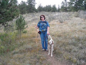
On Sat afternoon Sam and Christie met us at our house and we drove up to Pinewood lake. After 10 minutes of switchbacks and popping our ears we arrived at the trailhead parking lot, 1000 ft higher than we started. It was a perfect fall day in Colorado: 70 degrees, blue sky and a light breeze.
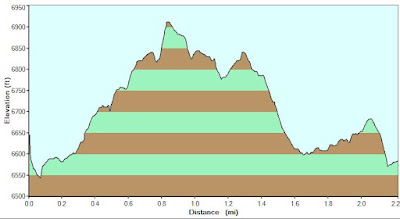
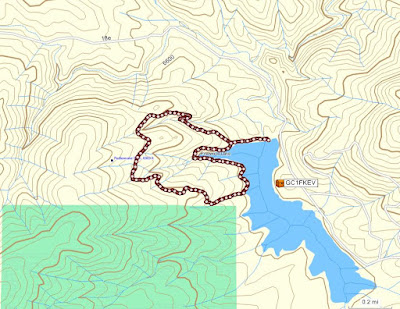
The trail started on the north end of the parking lot - across the dam and bear right, on the narrow trail heading upward. The first mile of the trail was by far the hardest, with constant uphill and switchbacks. We climbed for a total of 325 feet of elevation gain.
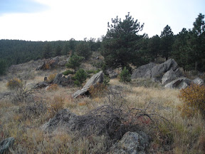
Once we made it to the top of the ridge, we were rewarded with some interesting rock formations and a beautiful view of the lake and surrounding hills. These rocks looked like a miniature version of the flatirons:
The trail continued for another half mile or so along the top of the ridge, with mild ups and downs. The trail was nice and wide, and the views were great all along this section.
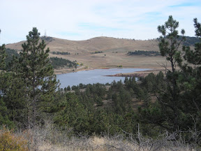
We continued on downhill for the next quarter mile until we came to where the Shoshone trail joins the Besant Point trail, right at the shoreline of the lake. Shy-Ann got very excited when she saw the water (she loves going to the lake!) so we decided to take a break to let her go swimming. Stacie found a loose pine cone to through so that Shy-Anne could practice water retrieving (and somehow I didn't take a single picture during this). Eventually Shy-Anne got cold in the water so we decided to move on.
The last leg of the trail is an easy walk along the shore of the lake. The trail winds around a small inlet called Fisherman's Cove; at this point we had the choice of staying with the easy path along the shore line or taking the more challenging path that cuts up and over the hill. We took the more difficult path, climbing up the ridge and then back down the other side. From there was a short walk around the last bit of the lake shore and back across the dam to the parking lot.
Trail Information:
Name: Shoshone Trail
Location: Pinewood Reservoir (west of Loveland, CO)
Length: 2.3 miles
Difficulty: Moderate to Easy
Download GPX file: Shoshone Trail.gpx
Map:
Elevation Profile: