Colorado Walkabouts

Hiking, Biking, Camping, Four wheeling

Showing posts with label Driving. Show all posts

Fall River Road

Published by Carl under on 7/25/2009 09:31:00 PM

We drove up Fall River Road for the first time this weekend, heading to the Chapin Creek trailhead to do some hiking.  Fall River Road is the old route through RMNP before Trail Ridge Road was built.

The road starts at Endovalley, in Horseshoe Park.  Fall River Road is a narrow, winding dirt road; you cannot take RVs or trailers on it.  Because it is so narrow and there are so many blind corners the road is only one-way; you have to take Trail Ridge back down.  There are some curves so sharp that you have to stop and back up to get around if you don’t set it up correctly from the beginning.

Despite all of this (or perhaps because of it ) Fall River Road is a fun drive. We were able to comfortably go at about the 15mph speed limit in the Hummer, but many cars and SUVs were going much slower through the ruts and around the corners.  All of them were courteous enough to pull over in the wider spots to let us pass.

In the lower, forested section of the road we saw plenty of wildlife.  Several times we had to stop to get around groups of marmots in the road.  They appeared to be chewing on the rocks in the road for some reason.  At point we also saw a snowshoe hare bounding across the road.  They’re primarily nocturnal, so we were lucky to see one.  It had its full brown summer coat on.

Shortly before tree line we got the the Chapin Creek trailhead and parked to hike Mount Chapin.  When we got back we continues our trip up the road.

After we got above tree line we didn’t see any other animals, but the views of the surrounding peaks made up for it.

Once we made it up to the Alpine Visitor Center we turned out onto Trail Ridge Road and headed east toward home.  A little way down the road there was a group of elk causing a traffic jam from onlookers.  A park ranger was having to stand in the road and direct traffic to keep it moving.

We had originally planned to stop at Rock Cut and hike the short trail there, but it was mobbed with tourists so we kept on going.  As we headed down the road we got a few last glimpses of Mount Chapin and the Mummy Range before we left the park and headed home.

View all of the pictures: Photo Gallery

Read the rest of this post...

Trail Ridge Road

Published by Carl under on 5/23/2009 10:38:00 PM

We were itching to get up into the high country over Memorial Day weekend, but we wanted to avoid the crowds.  I was especially excited about trying out the new hiking boots that I had picked up the day before.  We decided to combine a drive and a hike by going to Rocky Mountain National Park and driving over Trail Ridge Road to the west side of the park.  Once we got there we planned to take a hike and then drive back home.

The weather was iffy down in Loveland, but we decided to give it a try anyway.  We loaded up the Hummer and headed to RMNP.  Once we got in the gate we stopped in at the Beaver Meadows visitor center to buy a hiking guidebook and a map.  While we were there Stacie decided to pick up a stuffed Pika; since we can’t bring our dogs with us to the park, he’ll be our companion on our adventures in RMNP.

After the visitor center we continued through the park to Fall River Road.  Our original plan was to see if the road was open and take it up instead of Trail Ridge if we could.  There is a trailhead several miles up the road we wanted to hit.

Unfortunately, we were grossly optimistic about Fall River Road being open; it’s typically buried under snow until much later in the season, and this year was no different (it’s scheduled to open in July).  Instead, we drove back over to CO-34 and headed up the pass.

As we climbed, we started seeing large amounts of snow along the side of the road, but the driving conditions were still good.  Once we got higher, however, we started to climb into the clouds and the fog across the road started getting thicker.

As we kept going, the fog got thicker, the snow got higher, and the temperature dropped.  We had to slow down to about 25mph to see through the fog.  It was a complete white-out around us, with visibility limited to about 60 feet; unfortunately we couldn’t see any of the scenery we had hoped to enjoy.  There were several long sections where the snow on the side of the road ranged from 6 feet up to 14 feet deep, and the temperature was in the mid 30s.  We had originally planned on stopping at the Alpine Visitor Center, but we came up on it in the fog to suddenly to turn in.

Finally, as we started down into the west side of the park we dropped below the clouds again and rediscovered the sunshine.  The weather on the west side was quite a bit better than it had been on the east side of the park or even down in Loveland, although there was still plenty of snow.

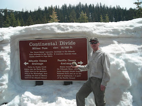
When we got to the continental divide of course we had to stop and take some pictures.  By this time we were well into the sunshine and the temperature had warmed up by 20 degrees.

After the continental divide we continued a short while longer to the Colorado River trailhead.  There is a large parking lot here and picnic tables as well as the trailhead, so we decided to park and have lunch before we started our hike.

After a light lunch we hiked for a while along the Colorado River (read about it here). After our hike we packed up and headed back over the pass.  The fog was actually even thicker this time, with visibility down to 15 – 20 feet.  It seemed to take forever to get back to the east side of the park, and we were very glad to be back out of it when we finally did.

Stacie’s hiking boots had gotten wet through to her socks by the end of the hike; they are low height, non-waterproof, lightweight boots made for summer hiking.  On the way home we stopped in to Outdoor World in Estes Park to look at some waterproof, mid height boots for her to use during the spring hiking season.  We ended up selecting another pair of Merrell boots for her.  We then stopped in at the book store and picked up a couple more guide books for RMNP and northern Colorado hikes.  These will help us achieve our goal of getting out hiking every single weekend this summer!

See all of the pictures: Gallery

Read the rest of this post...

Searching for Elk in Rocky Mountain National Park

Published by Carl under on 5/17/2009 10:39:00 PM

On Sat Stacie and I met Jenny and Wes up in Estes Park.  Jenny wanted to see some elk, so we drove up into Rocky Mountain National Park to find some.  On the way in Stacie and I bought a “National Parks and Federal Recreational Lands Annual Pass” – it gives us access to any federally operated recreation site across the country for one year.  That’s all of the national parks, federal recreation lands, open space, etc.

We entered the park through the Beaver Meadow entrance and headed straight to Moraine Park (left onto Bear Lake road, right onto Campground Rd, left on Fern Lake Rd).  Since Stacie used to work in and around RMNP and Estes Park she knew exactly where to take us.

Shortly after we entered the moraine we saw our first group of elk off close by on the right side of the road, and another in the distance on the left.

The scenery in the moraine is fantastic; you are in a large, level area surrounded by mountain peaks.

We drove down to the end of Fern Lake Rd to the Fern Lake trailhead.  Read about our hike here.  Once we were finished hiking, we drive back and saw even more elk than on the way down.  They were right up next to the road in several spots.

On the way out of the park, we drove around a little bit more to see if we could find some more elk or even bighorn sheep.  We did find another huge herd of elk in Horseshoe Park and sat for a while as they crossed the road.

We had a great time hanging out with Jenny and Wes.  Plus, the weather was perfect and the scenery was incredible; we can’t wait to go back to RMNP!

See all of the pictures here: Photo Album

Read the rest of this post...